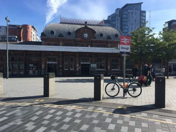
Map of Slough station, London

Photo: Martin W
Slough station
| Postcode | SL1 1XW |
|---|
Transport
| Travel zone | Outside zone 6 |
|---|---|
| Tube/Rail lines | |
| Next stations | |
| Nearby stations | |
| Bus stops |
Brunel Way ()
Slough Bus Station ()
Wellington Street (W)
Queensmere (W)
Queensmere Car Park (W)
Stanley Cottages (S)
|
| Station code (TLC) | SLO |
| Station code (NLC) | 3172 |
| Owner | Great Western Railway |
| National Rail Enquiries | |
Live Departures
Live Arrivals
Usage
Entries and exits
Interchanges
| Year | Entries and exits | Annual change % | Interchanges | Annual change % |
|---|---|---|---|---|
| 2024 | 5,383,958 | 18.9 % | 1,303,751 | -1.4 % |
| 2023 | 4,527,632 | 28.9 % | 1,322,225 | 70.7 % |
| 2022 | 3,512,514 | 150.3 % | 774,715 | 189.7 % |
| 2021 | 1,403,354 | -74.7 % | 267,403 | -84.4 % |
| 2020 | 5,546,280 | -1.7 % | 1,714,819 | -1.0 % |
| 2019 | 5,640,278 | 1.7 % | 1,732,888 | 8.6 % |
| 2018 | 5,544,320 | -2.2 % | 1,595,084 | -3.2 % |
| 2017 | 5,670,498 | 2.6 % | 1,648,181 | 1.7 % |
| 2016 | 5,529,074 | -0.6 % | 1,621,268 | -0.3 % |
| 2015 | 5,561,672 | 0.5 % | 1,625,495 | 2.0 % |
| 2014 | 5,533,844 | -0.7 % | 1,594,087 | 1.5 % |
| 2013 | 5,573,708 | 2.1 % | 1,570,311 | 3.4 % |
| 2012 | 5,460,832 | 5.6 % | 1,518,597 | 13.3 % |
| 2011 | 5,171,144 | 7.9 % | 1,340,427 | 7.3 % |
| 2010 | 4,791,482 | -2.1 % | 1,248,959 | -23.0 % |
| 2009 | 4,896,606 | 0.4 % | 1,622,069 | 41.9 % |
| 2008 | 4,879,229 | 5.8 % | 1,142,869 | 17.2 % |
| 2007 | 4,611,646 | 6.3 % | 975,206 | 11.3 % |
| 2006 | 4,336,985 | -2.5 % | 876,450 | -2.5 % |
| 2005 | 4,448,715 | 898,861 |
Note: Data is for financial years, so 2020 is April 2019 to March 2020
Geography
| Latitude | 51.51188 | |
|---|---|---|
| Longitude | -0.59151 | |
| Easting | 497838 | |
| Northing | 180157 | |
| Grid reference | SU978801 | |
| UTM reference | 30U 667125 5709500 | |
| what3words | ||
| Plus code | ||
| Distance away |
Postcodes
This map shows the postcodes where this station is the nearest to the postcode (as the crow flies)